Surroundings

Pazo da Pena presents itself as the perfect location for lovers of rural life and nature; of hiking and wine tourism, and of course, for those who enjoy discovering more about the legacy of the prehistoric Celtic culture; works of Roman and Medieval engineering and also for exploring and learning more about religious-artistic heritage, much of which can be found hidden and upheld in our mountains.
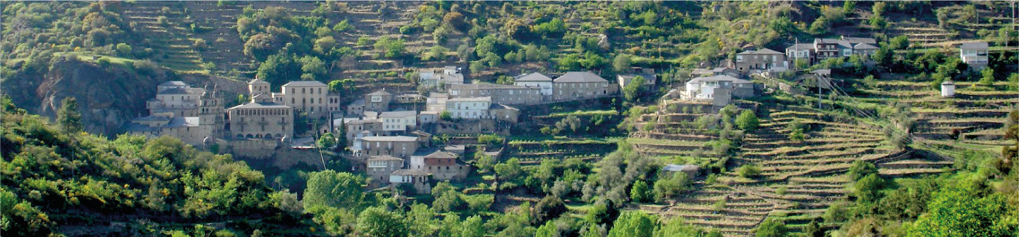
The territory of the Trives region occupies a large part of the Macizan Central Mountain Range of Ourense, the second largest protected area in Galicia. Forests full of native trees that envelop fairy-tale hamlets, which guard the footsteps of ancient civilisations and defend their artefacts. This explains why the region was such an important meeting point for the nobility of Galicia, as to be witnesses to its beauty and the purity of air that one can breathe here.
PLACES OF INTEREST
 Medieval village of Manzaneda
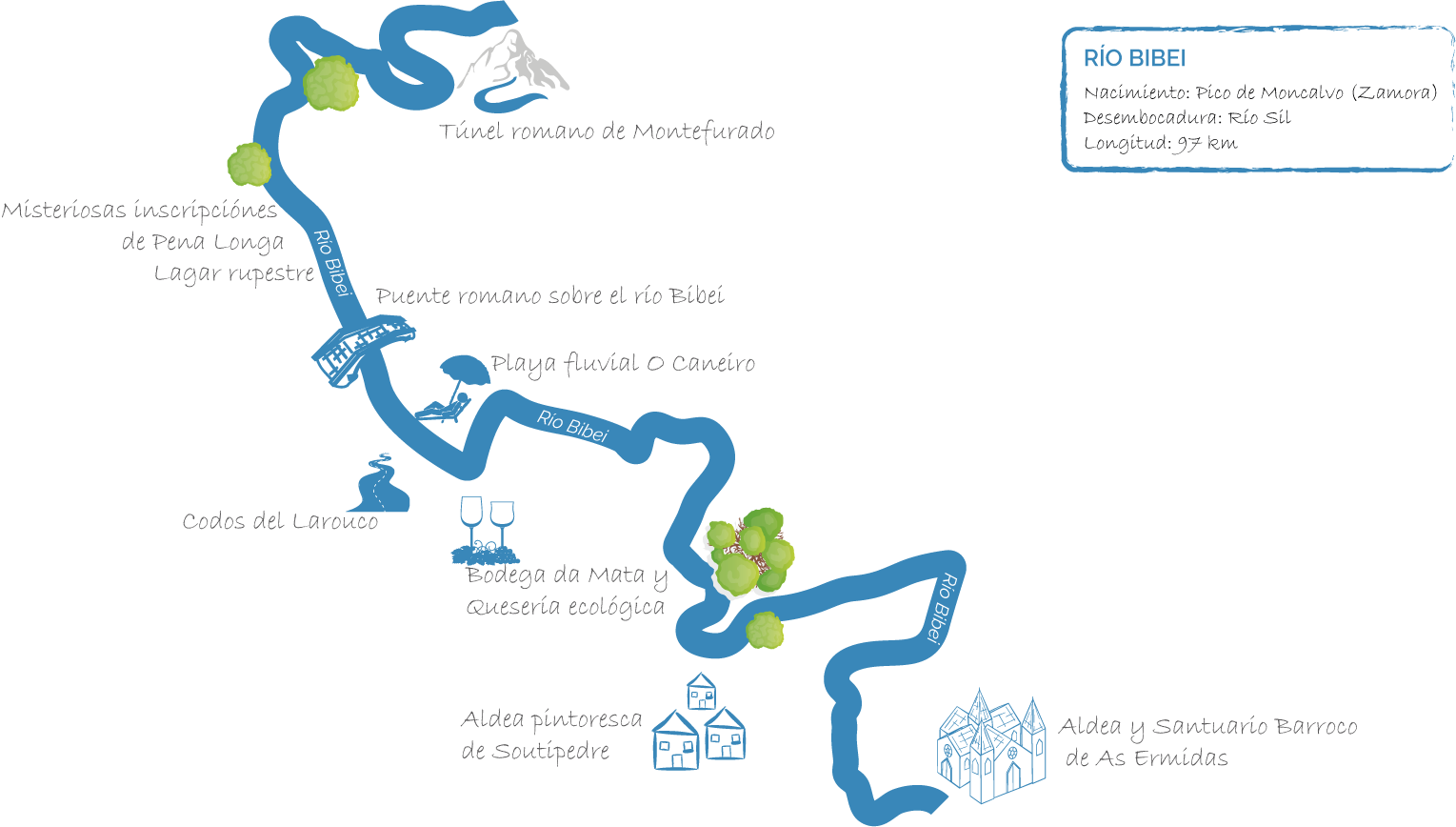
 Roman bridges of the Vía Nova over the Bibei, Cabalar and Navea rivers.
 Pomabiños Chestnut tree in the groves of Rozavales
 Touristic town of A Pobra de Trives
 Village and baroque sanctuary of As Ermidas
 Beautiful viewpoint of the Forest of the Rock (Pena Folenche) and its woods
 Monastery of San Salvador de Sobrado from the 11th Century
 Roman tunnel of Montefurado

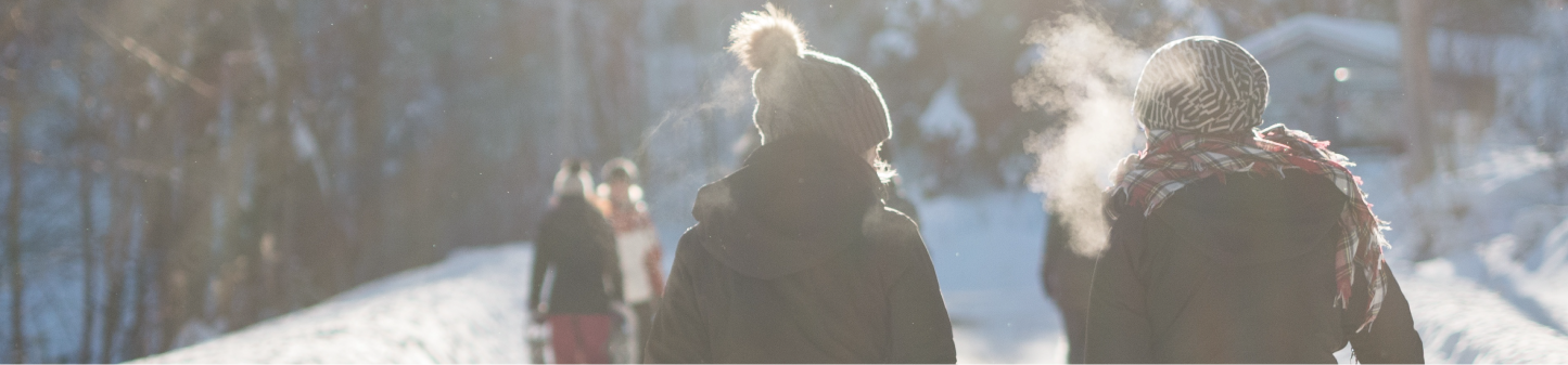
Situated in the highest peak of the Macizan Central Mountain Range of Ourense one will find a ski station and mountain sports tourism centre open all year round. Located on the Cabeza Grande, or High Peak, of Manzaneda standing at 1778m, it is immersed in a Pine forest of over 2,000 hectares, giving it an incredible beauty, especially in winter. It was one of the first ski stations to invest in the possibility of enjoying the mountain all year round, no matter the season, by offering a vast number of activities.
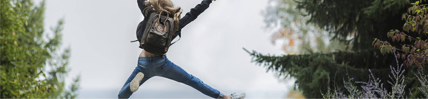
ACTIVITIES AND INSTALLATIONS FOR FAMILIES
-
 Snow sports
 BTT
BTT
 Quads
Quads
-
 Climbing wall
 Tennis courts
 Outdoor multi-use sports pitch
-
 Heated swimming pool
 Hiking
 Zip lining
-
 Archery
 Grass football pitch
 Café and Restaurant
-
 Thermal Spas
 Horse trekking
 Adventure park
-
 Go-kart track
 Sports hall
 Mountain clothing shop
In the section of the Virtual Tourism Map about Detox Tourism (Turismo Detox) you will find a complete list of the different activities that allow you to connect you with the nature that surrounds us: areas to swim in the rivers, walking and hiking routes, activities and mountain biking. All are organised in the legend in two sections: the first contains the activities directly situated around the manor under the title of Detox Activities Nearby (Actividades Detox Cerca), and the others which are further away from the manor with the title Distant Detox Activities (Actividades Detox Lejos).
POPULAR DETOX ACTIVITIES IN THE AREA

RIVER BEACH O CANEIRO (RIVER BIBEI)

RIVER BEACH DE AS HERMIDAS (RIVER BIBEI)

WALK THROUGH THE MEDIEVAL TOWN OF MANZANEDA

WALK TO THE POMBARIÑOS CHESTNUT TREE IN THE GROVE OF ROZAVALES

WALK THROUGH THE FOREST OF THE ROCK (PENA FOLENCHE)

ROUTE OF THE SOTOS DE CESURIS
Submerge yourself in the beauty and mystery of the groves (Sotos) of Manzaneda

ROUTE OF THE PRADA AND AS LAMAS GLACIERS
Visit Prada, a lovely abandoned hamlet in the ancient glacier.

ROUTE THROUGH OS CURROS
Venture out in the Sierra de Queixa and search for its authentic havens

ROUTE OF THE BIBEI CANYON
Discover the exquisite natural paradise of the River Bibei

ROUTE OF THE NEW WAY (VÍA NOVA) Via the Navea, Cabalar and Bibei rivers
Follow in the footsteps of the Roman Empire and their spectacular feats of engineering.

ROUTE OF SAINT JOHN’S FOREST FRAGA DE SAN XOÁN DE RÍO
Go inside of the Oak forest of Navea, the Galician forest of the Celtic druids.
One of the best kept secrets of central Galicia, which have an element in common, are the fluvial course of the Miño, are the Sil and Bibei rivers.
These important rivers, and their tributaries, meander through the countryside in often very steep canyons, others less so, leaving in their wake unique scenery and landscape, elected since yesteryear as a place of retreat. It is also the area where it is possible to find the highest concentration of Roman-style religious constructions in Europe.
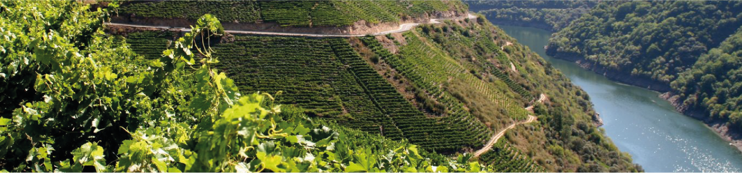
Furthermore, its climate has favoured the development of one the most important wine making regions since the time of the Romans.
RIBEIRA SACRA VALLEY OF THE BIBEI
The river Bibei, in its last stretch before joining and pouring all its water into the river Sil in Montefurado, presents us with the canyon of the Bibei, a place even until now is still almost unknown. It allows it to show off a virgin and authentic landscape marked, of course, by the ancestral and heroic winemaking industry, which is seen throughout the Ribeira Sacra, cultivated for 2,000 years since Roman times.
RIBEIRA SACRA OF THE SIL CANYON OF THE RIVER SIL.
The river Sil, from Quiroga until its outlet in the river Miño in Os Peares, runs through several canyons of tectonic origins with sharp contrasts in its slopes and with huge boulders, vegetation and tranquil waters. To take a boat journey along the river is one of the best ways to appreciate its deviations of more than 500m in some places and with gradients of more than 50%, some of which are almost vertical.
Its climate also presents important variations, exhibiting a humid-Mediterranean climate in sunny slopes, ideal for cultivating vines in the famous terraces which extend all the way to the river banks; and its extremely humid-Atlantic climate in the more shaded parts of the canyon, as is found in its forests and river plains.
 High altitude
viewing areas
High altitude
viewing areas Wineries open to
the public
Wineries open to
the public Boat trips along
the canyons
Boat trips along
the canyons Kayaking along
the river Sil
Kayaking along
the river Sil Visit the monasteries
of the Sil valley
Visit the monasteries
of the Sil valley
Virtual Tourism Map, All this information, and much more, can be found in our Virtual Tourism Map, created especially for our guests.
In it, you can find all that you need to know in order to come and explore our region and those surrounding us, to enjoy the wine tourism of the Ribeira Sacra and Valdeorras, and to experience the Detox Tourism that you were looking for. All tourist information can be found here with just one click.